Tourist Guide

A Short Visitor's Guide to Seattle

Not exhaustive — just the eight stops locals point newcomers toward most often, from the market stalls downtown to a lighthouse at the edge of the city.

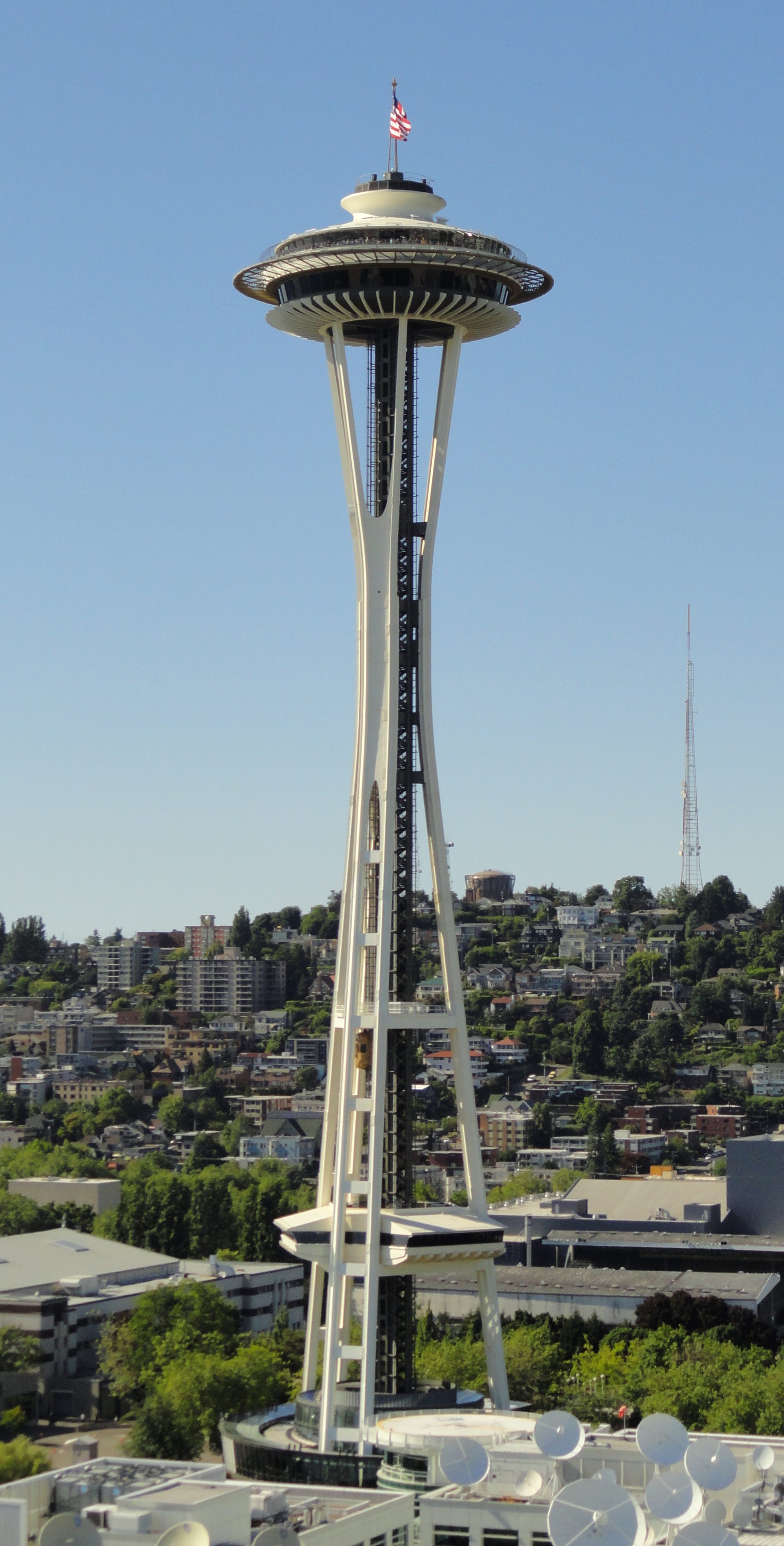
The Space Needle against a clear sky
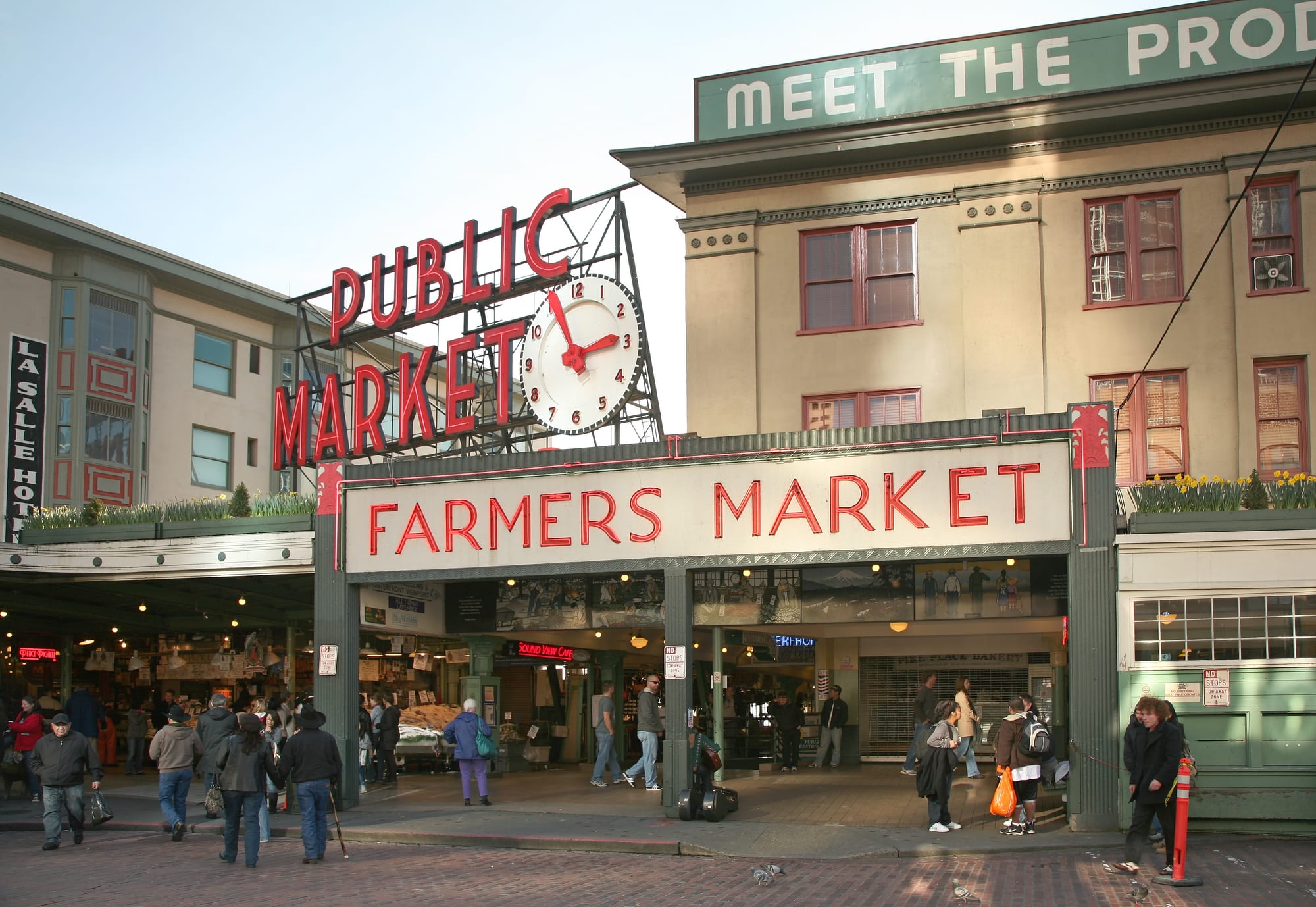
The Public Market Center clock and Farmers Market sign above the entrance to Pike Place Market, with crowds on the sidewalk below
Stop 1 · Downtown

Pike Place Market

Seattle's working public market since 1907 — fish throwers, flower stalls, and the original Starbucks storefront down the street. Go early for the produce stands, stay for the street musicians.

Photo: Steve Morgan, CC BY-SA 4.0, via Wikimedia Commons
The Space Needle rising above Seattle Center
Stop 2 · Seattle Center

Space Needle

The 1962 World's Fair tower still anchors the skyline. The observation deck's glass floor isn't for everyone, but the view of the Olympics and Puget Sound is worth the elevator ride alone.

Photo: Public domain, via Wikimedia Commons
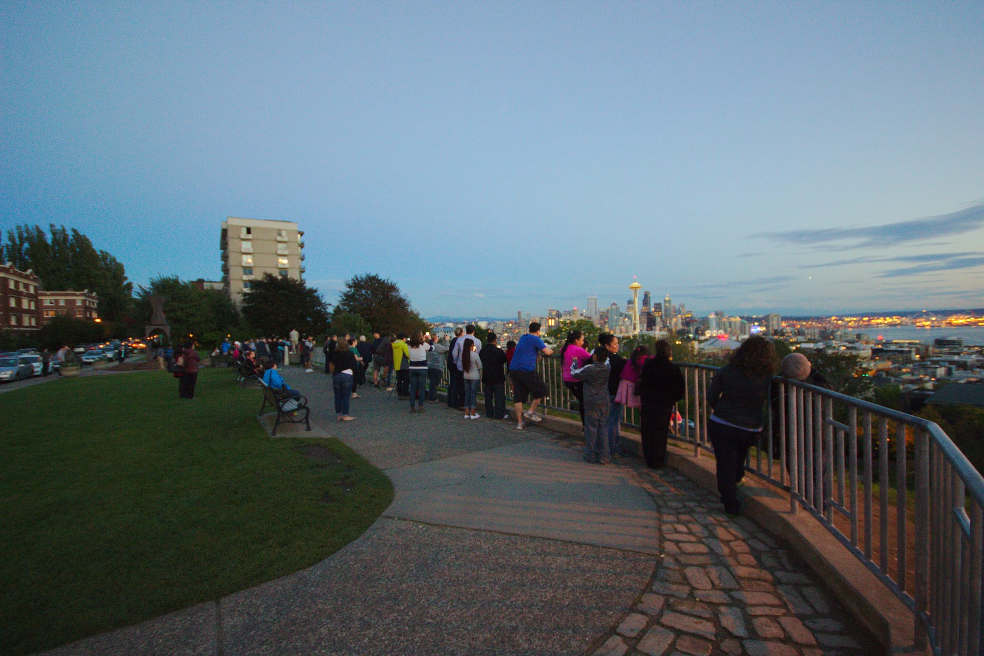
Visitors lined up along the railing at Kerry Park at dusk, looking out over the Seattle skyline and the Space Needle
Stop 3 · Queen Anne

Kerry Park

A small hillside viewpoint with the single most photographed skyline shot in the city — Space Needle in front, Mount Rainier behind it on a clear day. Best right around sunset.

Photo: Sage Ross, CC BY-SA 2.0, via Wikimedia Commons
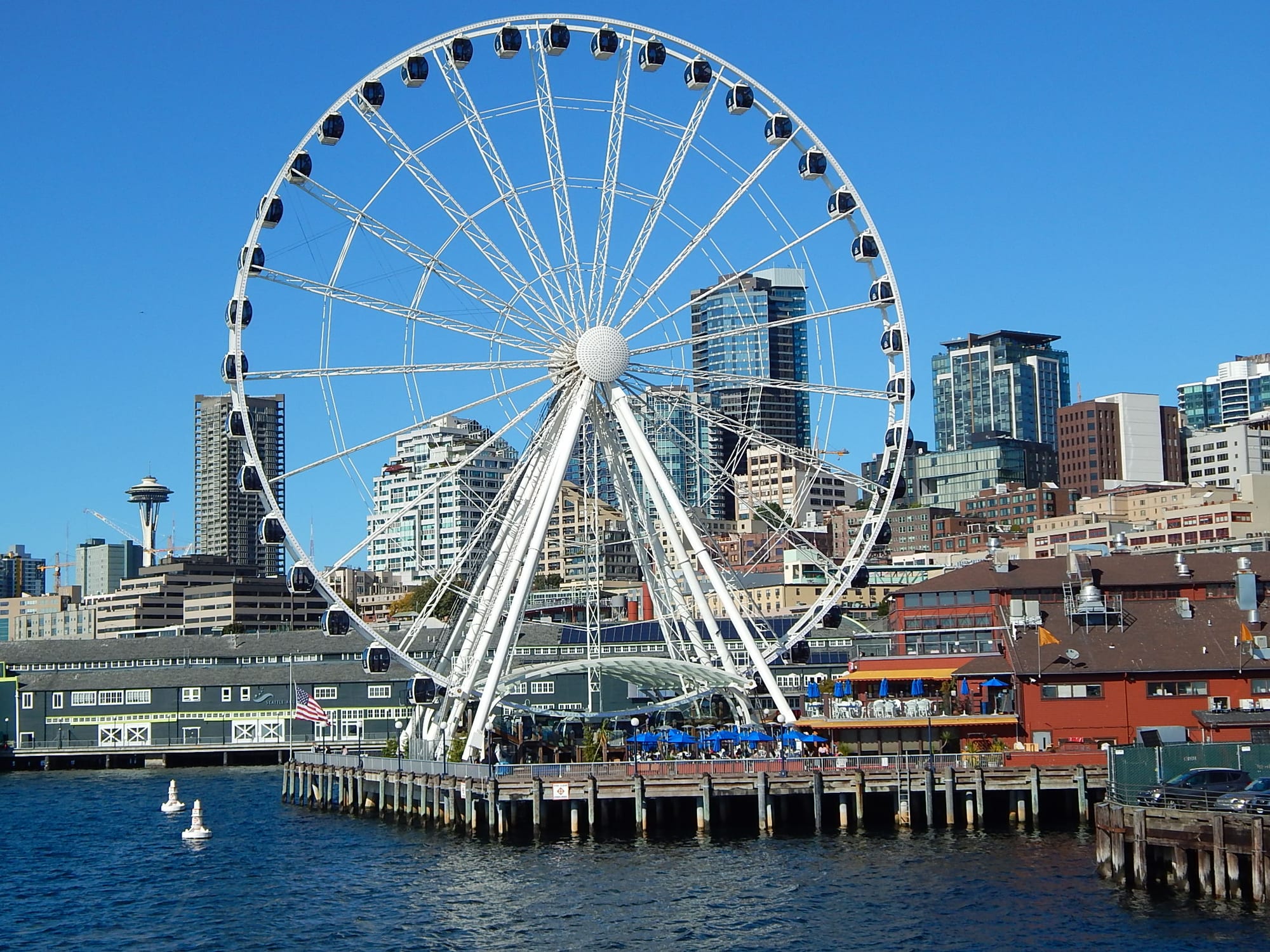
The Seattle Great Wheel ferris wheel on Pier 57 with the downtown skyline behind it
Stop 4 · Downtown Waterfront

Seattle Great Wheel

A 175-foot ferris wheel at the end of Pier 57, lit up along the waterfront after dark. Pair it with a walk out to the water and a ferry to Bainbridge Island if you have the afternoon.

Photo: SounderBruce, CC BY-SA 4.0, via Wikimedia Commons
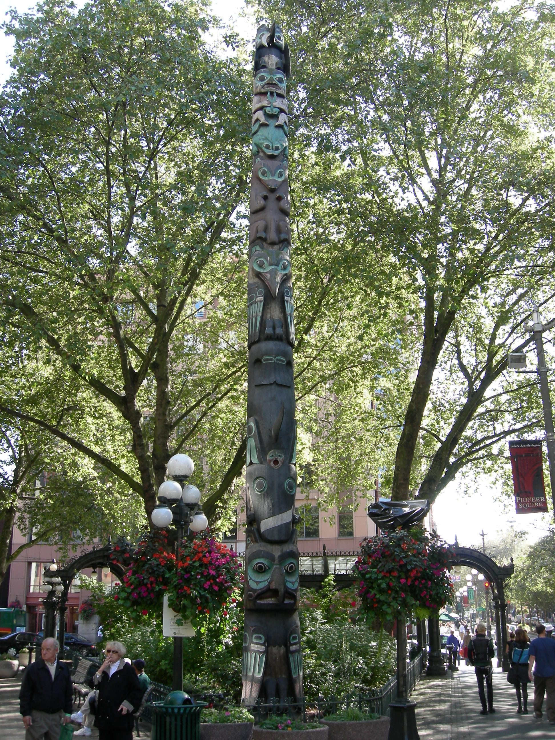
A tall carved totem pole surrounded by trees and hanging flower baskets in Pioneer Square
Stop 5 · Pioneer Square

Pioneer Square

Seattle's original downtown — brick-and-iron 1890s buildings, a carved totem pole on the square, and the Underground Tour running through the city's literal foundations below street level.

Photo: Joe Mabel, CC BY-SA 3.0, via Wikimedia Commons
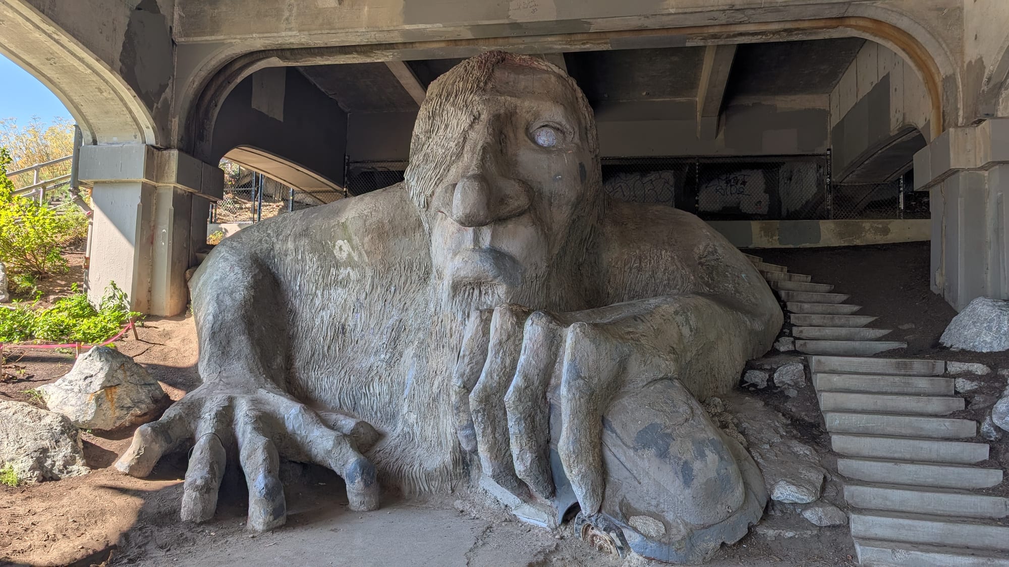
The concrete Fremont Troll sculpture crouched under the Aurora Bridge, gripping a car in one hand
Stop 6 · Fremont

Fremont Troll

An 18-foot concrete troll clutching a real Volkswagen Beetle under the Aurora Bridge. Equal parts public art and neighborhood in-joke — Fremont calls itself the 'Center of the Universe' for a reason.

Photo: Fremont_troll.jpg, CC BY-SA 4.0, via Wikimedia Commons
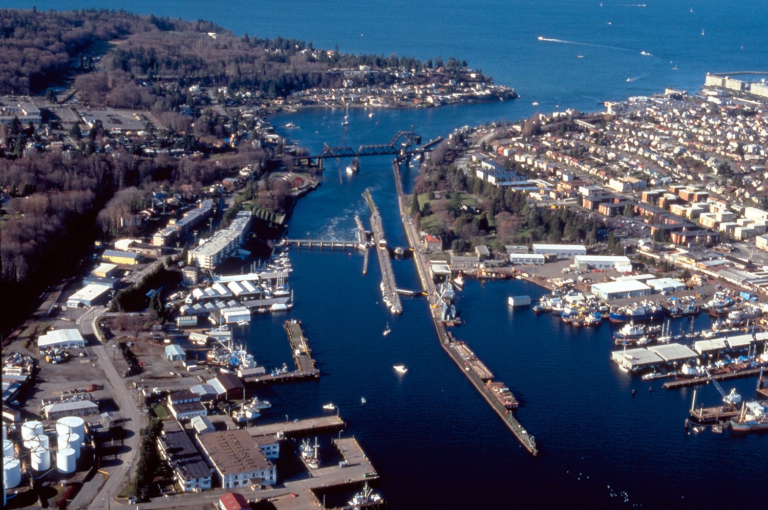
Aerial view of the Hiram M. Chittenden Locks connecting Salmon Bay to Puget Sound, with boats moored on both sides
Stop 7 · Ballard

Hiram M. Chittenden Locks

Known to everyone as the Ballard Locks — boats rising and falling between salt and fresh water, a fish ladder for migrating salmon, and a botanical garden right next door.

Photo: US Army Corps of Engineers, public domain, via Wikimedia Commons
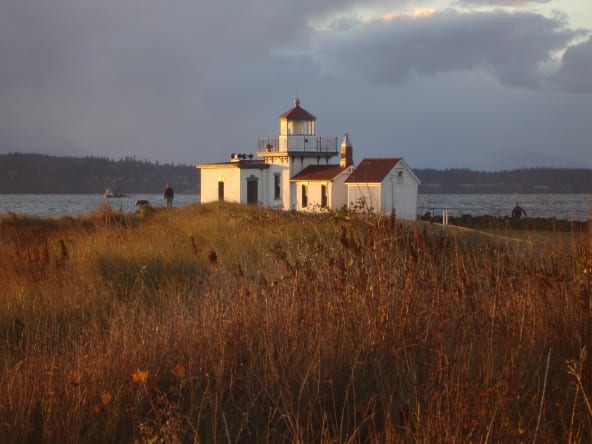
The West Point Lighthouse surrounded by tall grass on the Puget Sound shoreline in Discovery Park at sunset
Stop 8 · Magnolia

Discovery Park & West Point Light

The city's largest park — 500+ acres of forest, bluffs, and a working lighthouse on a real stretch of Puget Sound coastline. The quietest place in Seattle that's still inside the city limits.

Photo: Joe Mabel, CC BY-SA, via Wikimedia Commons

Getting Around

From the airport. Link light rail runs from SEA-Tac straight into downtown in about 35–40 minutes — cheaper and often faster than a cab in traffic.
Getting around. An ORCA card covers buses, light rail, and the streetcar on one tap. Downtown, Capitol Hill, and Fremont are all walkable once you're there.
Parking. Downtown parking is expensive and often full — if you're staying central, consider skipping the rental car altogether.
What to pack. A light rain jacket beats an umbrella — Seattle rain is usually a drizzle, and locals mostly ignore it.